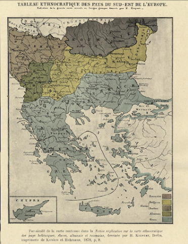
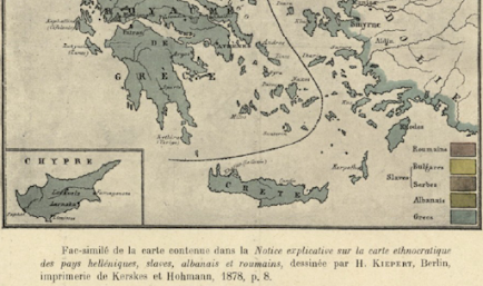
Rare ethnographic map by the German cartographer,Heinrich Kiepert
depicting Balkans
(a) The
ethnographic maps of the famous
cartographer who was distinguished for the scientific value of his maps, depicts the region of Macedonia. as being
inhabited primarily by Greeks and secondly by Bulgarians.
(b) neither Kiepert in his time knew any
fictitious “Macedonian” nationality. On the contrary the Slavs of his time were
Bulgarians and Serbs.
Geographer
Heinrich Kiepert (1818-1899) is generally reckoned one of the more important
scholarly cartographers of the second half of the 19th century. The fame
attached to the name of this renowned German geographer and cartographer, H
dates from the appearance of his distinguished Atlas von Hellas (1846).
Kiepert
acquired one of his interests-the historical geography of the classical world-in
his student days at the University of Berlin, where he worked with Carl Ritter
(1779-1859). Ritter and Kiepert produced what appears to have been one of the
first modern atlases of the ancient Greek world, Topographisch-historischer
Atlas von Hellas und den hellenischen Colonien in 24 Blättern (1840-1846).
Several additional compilations of maps of the classical world followed: Bibel-Atlas
(1847); Historisch-geographischer Atlas der alten Welt (1848); Atlas antiquus
(1854); Formae orbis antiqui (1893); and Formae urbis Romae antiquae (1896).
Many of these works were reissued in numerous editions, including translations.
Another
major interest was the Ottoman Empire, where Kiepert travelled numerous times,
gathering enough data to produce several major maps of the Ottoman world
between the 1840s and 1890s.
More Infos
about Heinrich Kiepert’s life are found in the University of Chicago Library


